
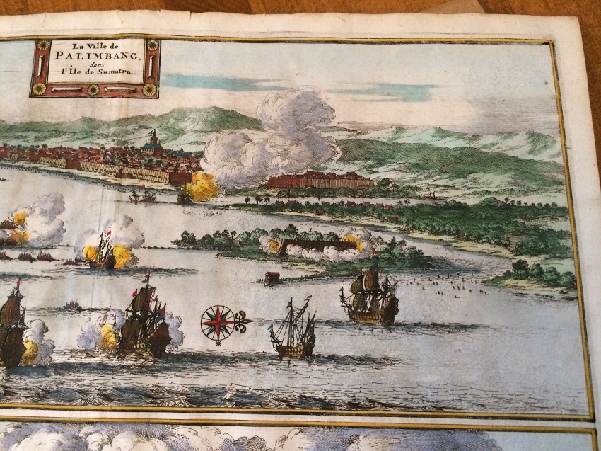
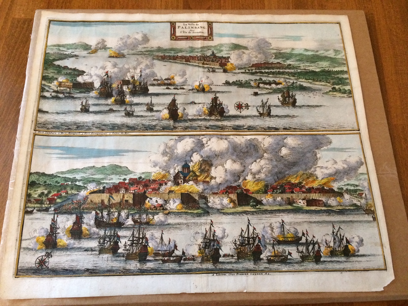
This is my latest collection of antique map. The title of the map is La Ville de Palimbang dans l’Ile de Sumatra.
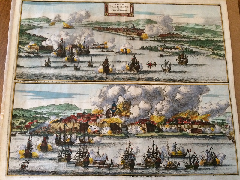
It is made by the Dutch cartographer Pieter Vander Aa.
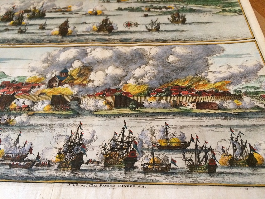
It describes vividly the naval battle of the VOC ships attacking the town of Palimbang (or Palembang its current name) in Sumatra (Sumatera) island.

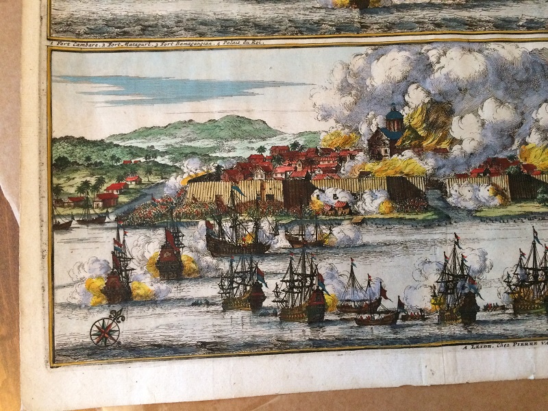
I know that the map is published in Leiden as it is said on the bottom of the map. However there are two accounts of when this map is published. The first account is that the map is probably published in 1719 in an atlas/travel book ‘Les Voyages du sieur Albert de Mandelslo‘. You can visit an electronic version of the book from a Spanish library here. If you click Copia digital, you can see the map on page 246 on the digital copy.
The second account is that this map is published in 1729 in Pieter van der Aa’s atlas book of La Galerie Agreabale Du Monde according to the information from the Bartelle Gallery here. Well, both of the sources probably right, that this map is published by two different books at two different times.
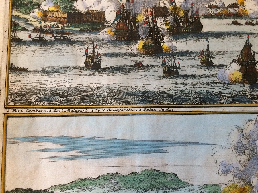
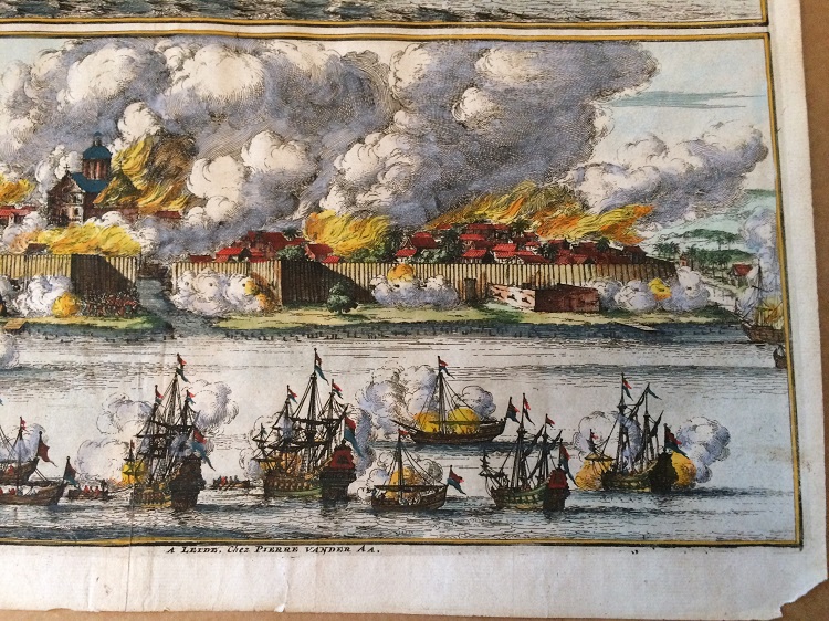
Anyway, there are two engravings in this map. Below is the first engraving.
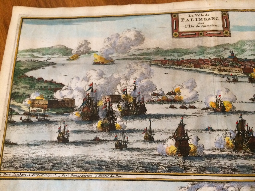
The first engraving shows four historical places: 1. Fort Cambare, 2. Fort Matapurl, 3. Fort Bamagangian and 4. The Royal Palace. You can see the VOC ships with their Dutch flags capturing these four historic places. The City of Palembang is under attack by the Dutch. Surely this is a historical evidence of the Dutch attacking Palembang probably in the 17th century. We can see from the engraving that all four places are under fire.
I am wondering who was the reign King or Sultan of Palembang at that time? His Palace and Forts are under attack.
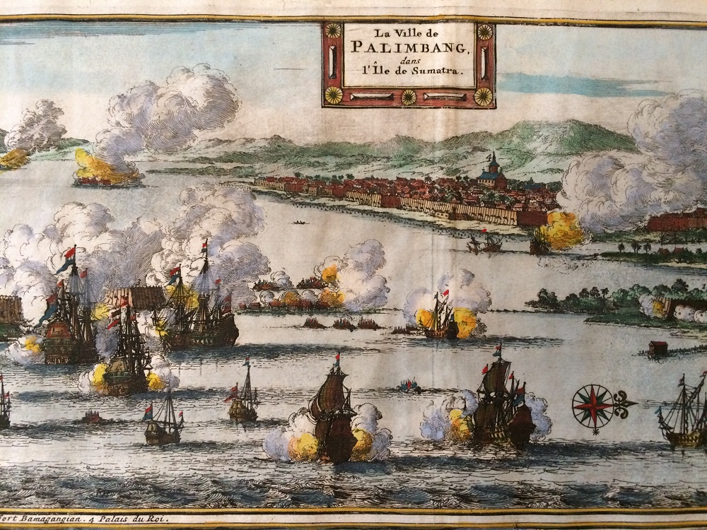
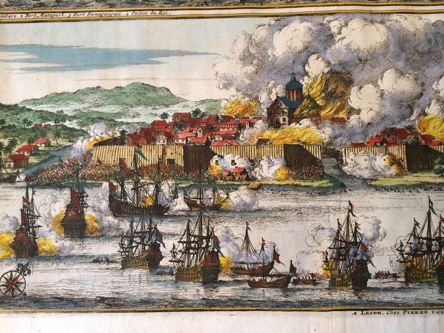
Here is the second engraving:
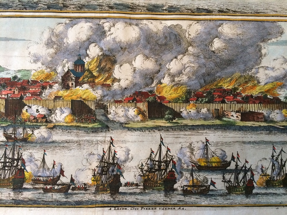
It is a closer look of the King’s Palace which is under siege by the Dutch’s VOC.
Can you spot Sultan ships? Are there any Sultan’s ships? I see only VOC ships here.
This is the look of the map from the back. It is blank with folding sign in the centre.
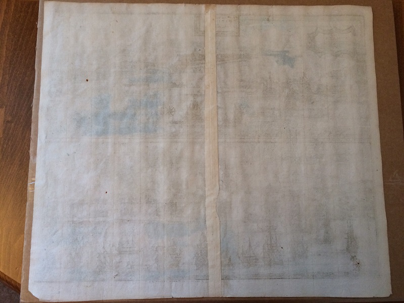
When I look at the map against the sunlight, I can see watermarks. I hope it is a good sign that this map is from the 18th century.
 Users Today : 38
 Users This Month : 1290
 Users This Year : 24783
 Total Users : 50084
 Views This Year : 29731
 Total views : 64909
 Who's Online : 0